IQ MOBILE SOFTWARE FOR TABLETS
General Information
RadioMobile’s IQ Mobile Tablet software provides mobile fleets with real-time mobile messaging and status updates while interfacing with applications such as CAD, mapping, AVL, and others via an iPad tablet application. IQ Mobile Tablet is configured to meet operational needs and is scalable to a variety of agency types and sizes.
Key Features
INITIAL DISPATCH
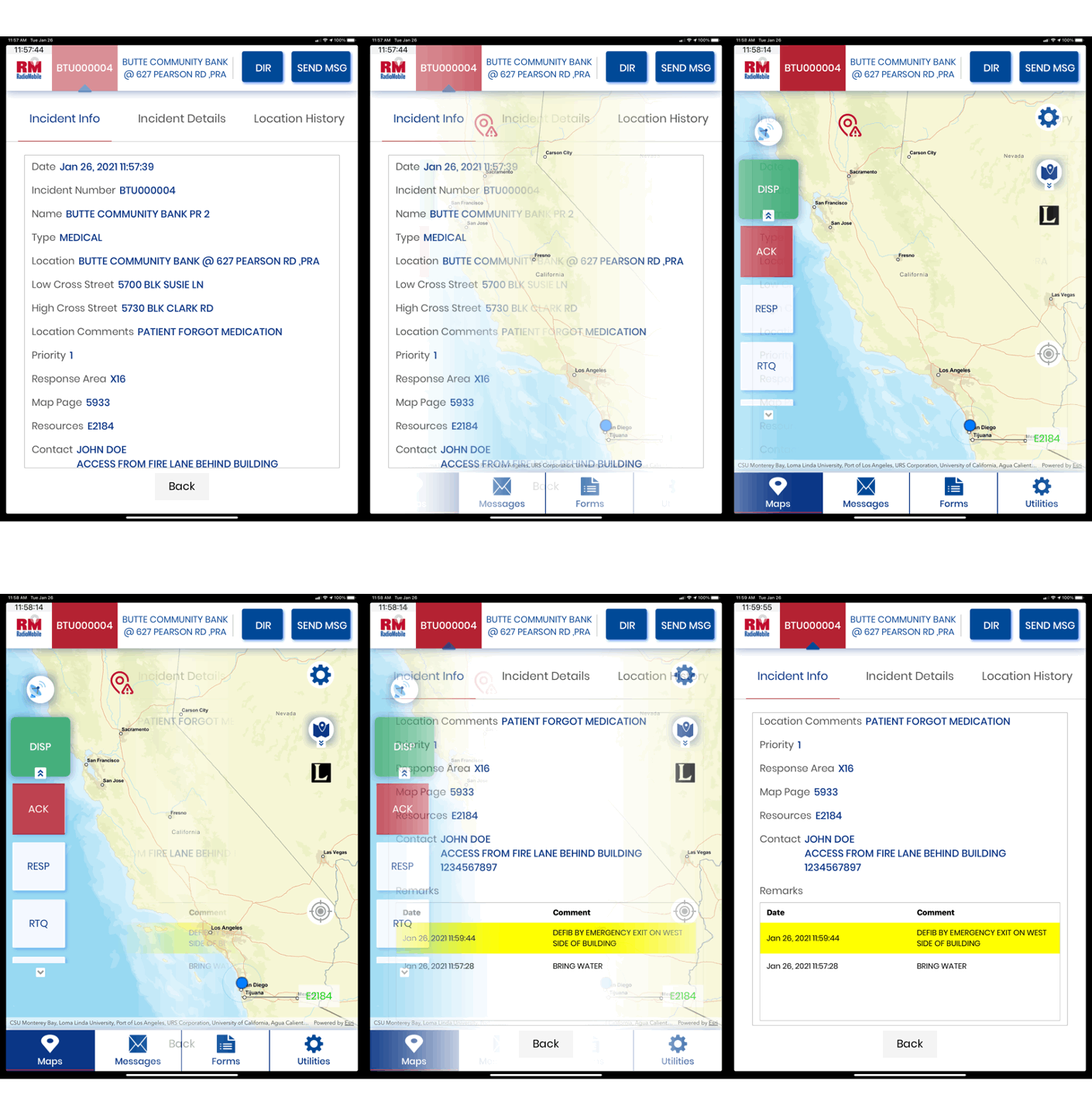
IQ Mobile Tablet clearly displays all information pertaining to the dispatch including address and location coordinates, assigned resources, caller information and remarks from the CAD operator. Using touch-screen interface, the user can accept the call with the press of a button that sends an instantaneous message to CAD. Status is automatically updated and timestamped indicating En Route, On Scene and other relevant status changes. Incident updates are received from the CAD automatically and changes are highlighted for quick reference.
NAVIGATION AND AUTOMATIC VEHICLE TRACKING (AVL)
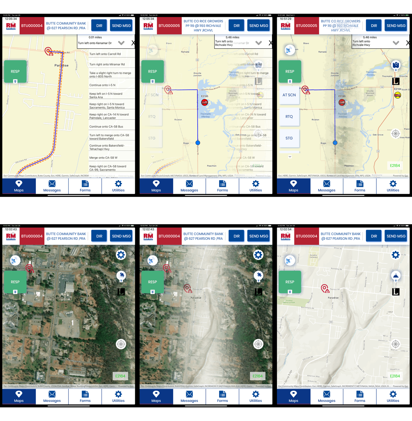
Using built-in GPS, IQ Mobile provides turn-by-turn directions to the incident. All vehicles are tracked and displayed simultaneously on the map by time, distance and status, giving responders and managers a clear view of all resources responding to the incident. User can switch between base, topo, and imagery views with the touch of the screen, and they can toggle on and off custom layers such as fire hydrants, parcels, historical fires and many others.
ACCESS TO CRITICAL DATA
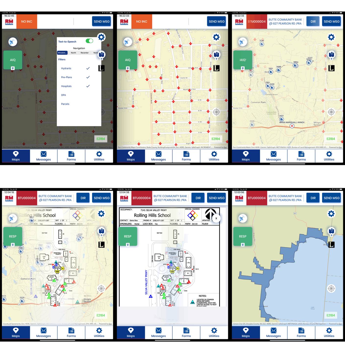
IQ Mobile puts all of the information regarding the incident and location at your fingertips. Map layers display features such as hydrants, power lines, fire history, CPNs, DPAs, parcels, railroads, facilities and administrative boundaries. Layers take the form of symbols and appear at different pre-defined zoom levels to avoid cluttering the map. Pre-plans are readily accessible with a touch of the screen, so you arrive at the scene prepared.


