IQ MOBILE SOFTWARE FOR MDCs
General Information
IQ Mobile Software MDC is a Windows-based application that provides emergency personnel with the critical data and communications needed to respond quickly and efficiently. Critical data is stored on locally where it can be accessed quickly and reliably. Advanced technology ensures communications and data are transmitted regardless of their location.
Key Features
INITIAL DISPATCH
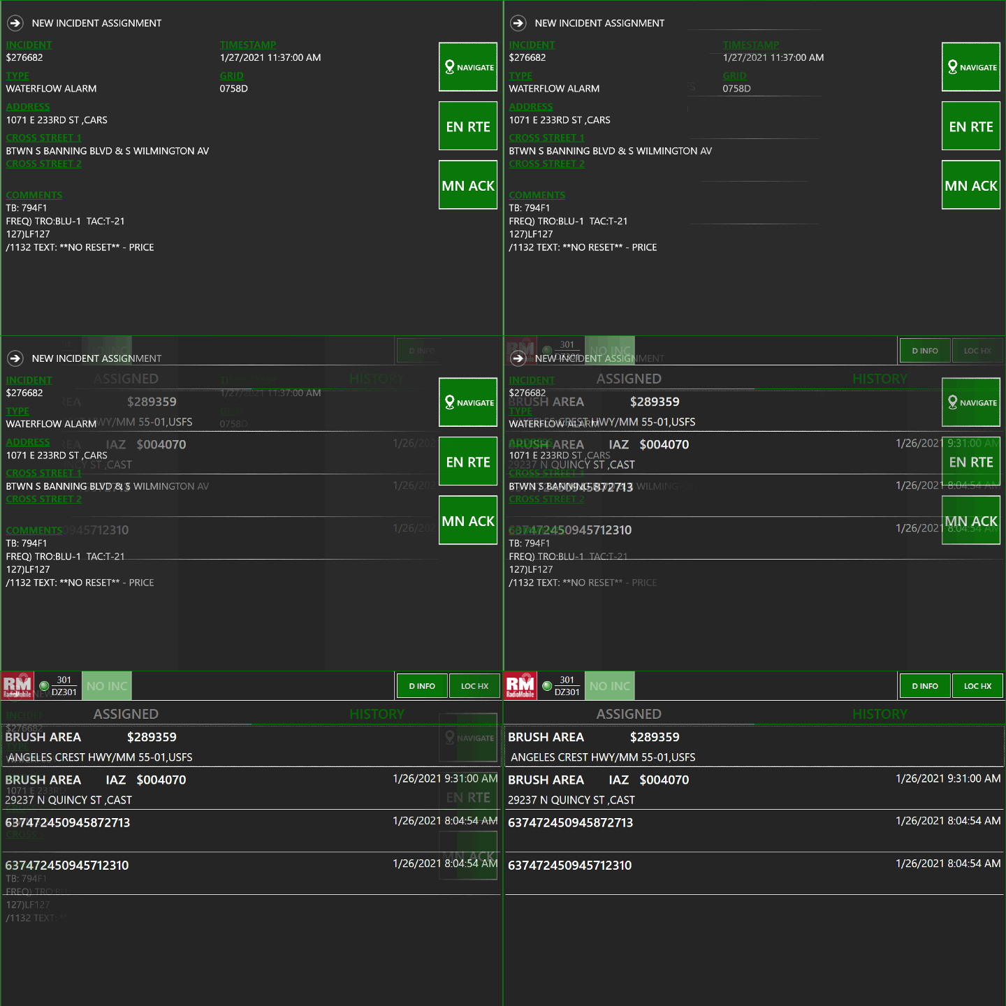
IQ Mobile MDC clearly displays all information pertaining to the dispatch including address and location coordinates, assigned resources, caller information and remarks from the CAD operator. Users can quickly toggle to view incident history. Using touch-screen interface, the user can accept the call with the press of a button that sends an instantaneous message to CAD. Status is automatically updated and timestamped indicating En Route, On Scene and other relevant status changes.
NAVIGATION AND VEHICLES TRACKING (AVL)
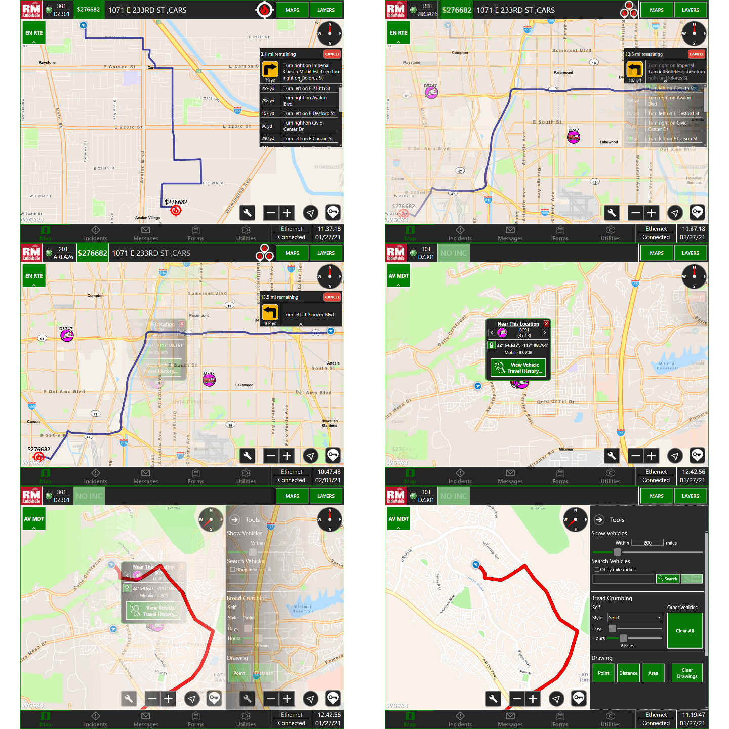
Using GPS signals from multiple redundant sources, IQ Mobile MDC provides turn-by-turn directions to the incident including optional text-to-voice instructions. All vehicles are tracked and displayed simultaneously on the map by time, distance and status, giving responders and managers a clear view of all resources responding to the incident. Optional breadcrumb trails allow users to track past vehicle routes.
MAPPING
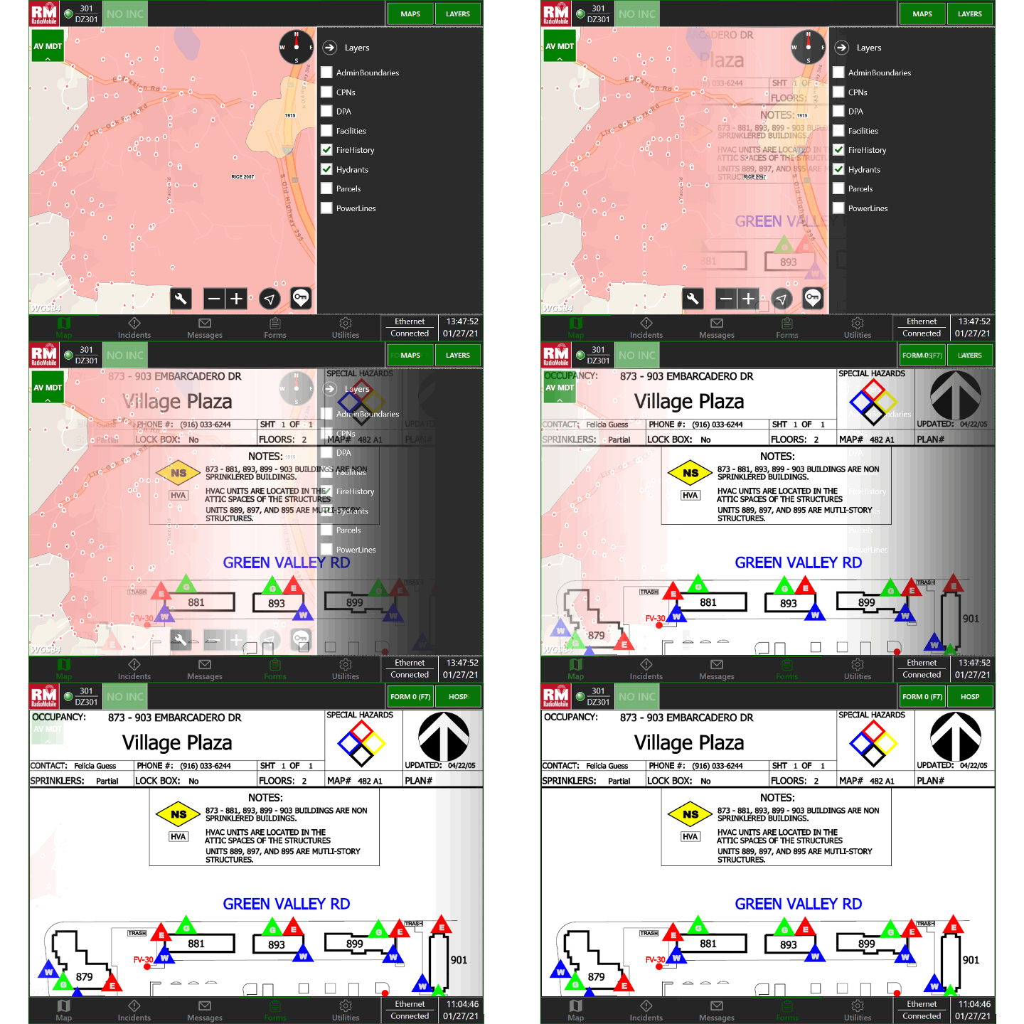
Users can switch between base, topo and imagery views with the touch of the screen and can toggle on and off custom layers such as fire hydrants, parcels, and historical fires. These layers are interactive and may be accessed both online and offline to conserve bandwidth. Mapping tools let users quickly determine the distance between two points or the area of custom shape.
ACCESS TO CRITICAL DATA
IQ Mobile MDC puts all of the information regarding the incident and location at your fingertips. Map layers display features such as hydrants, power lines, fire history, CPNs, DPAs, parcels, railroads, facilities and administrative boundaries. Layers take the form of symbols and appear at different pre-defined zoom levels to avoid cluttering the map. Pre-plans are readily accessible with a touch of the screen, so you arrive at the scene prepared.
Over-the-Air Updates
Seamless Integration
MOBILE DATA COMPUTERS
IQ Mobile Software seamlessly integrates with RadioMobile’s ruggedized, in-vehicle mobile data computers, so supervisors and responders know the exact location and status of emergency apparatus and personnel at all times.
VIEW FEATURES
- 2-way communication with CAD
- Text-to-voice navigation
- Real-time status updates
- Automatic vehicle location
- Custom map layers
- Pre-plan display
- Instantaneous mobile messaging
- Security/Encryption
- Multi-network connectivity management
- Locally stored data


